|
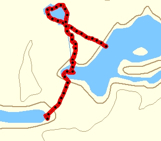
Day 6 Time: 9 hrs 20 min Distance: 2.7 km (45.8) Up at 9:30, no rain, breezy with a bit of sun showing through. I had some tea & oatmeal and did a 1st trip over the portage about 11:00, we did a second run then returned to take down the tent and carry the last load. On the other side we loaded and headed across the pond into a strong headwind. I could not see an obvious outlet; paddled most of the opposite bank but nothing, it suddenly dawned on both of us and was confirmed by GPS…we are not in the right place!!!! The portage trail that looked so obvious to be the way was in fact a trail to a tiny dead end pond! Unbelievable, we had camped out for a day and half and never made the effort to confirm our location by GPS or even by map. Looking back at my entry written on arrival two days ago"I located the take out, not exactly where I thought", well there was nothing that could be done now except to get back on track. The obvious thing would be to reverse the portage, I've never liked the backtracking approach, prefer to always maintain forward (or sideways in this case) momentum. Neither Steve nor I have anything but an extreme distaste of portaging, the thought of doing one backwards is so horrifying that any alternative regardless of how difficult and time consuming must be chosen.
|
|
|
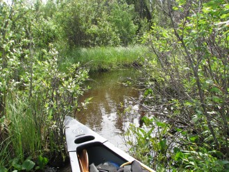
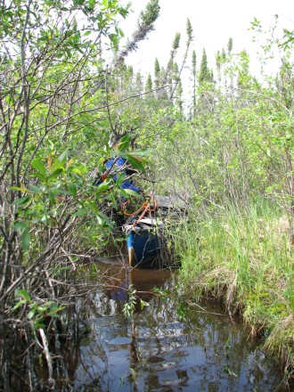
The map indicated a small outlet stream at the South end of what we are now referring to as Catch 22 Lake, I paddled over to find it, not always easy to locate an outlet that is only one or two inches wide hidden in a patch of grass, I pushed through the grass, then got out to drag the boat over a lump of earth, at the other side the "stream" was now about a foot wide with some detectable current, obviously this is the way out. Looking ahead it simply vanished into a thick patch of alders. We pushed and pulled out boats through this section of trees and bushes, the stream now 1 - 2 feet wide but all twisted around the growth. After bashing through this part we came to a section which was open but choked with moss and reeds, although we were able to "paddle" part of this for the most part I was pulling my boat, you need to be careful, one minute you are "standing" on squishy moss up to your knee in water, the next you step into the actual channel where it's 4 - 5 feet deep but still only a foot or so wide. The 3rd section was the longest and required the most effort, 2 man dragging (on 3, ah 1, ah 2, ah 3….UGH!), then some chopping and sawing as we tried to follow the route through. As we neared the end the growth was thicker, we spent as much time clearing alders as we did pulling the boats. Finally we could see the end was at hand. We were able to emerge afloat from the weeds.
|
|
|
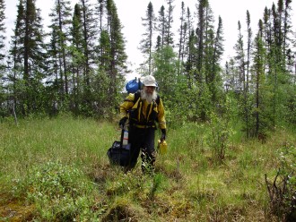
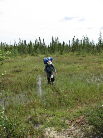
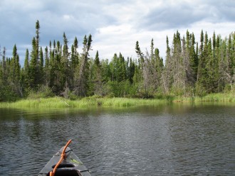
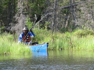
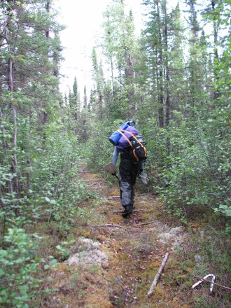
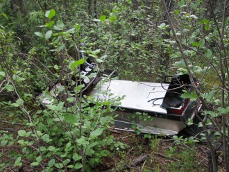
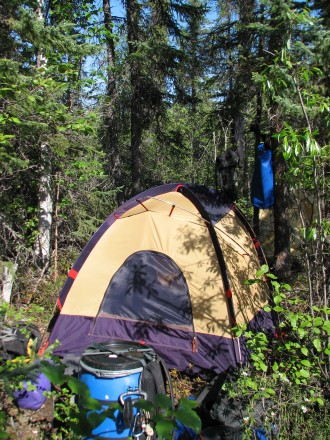
It was a bit of joy tempered by frustration knowing we were back on the lake we had started from 6 hours earlier not too mention just a few hundred meters down the shore. Steve paddled over to find the REAL portage at the south end of the bay; it's wet, not inviting but obviously more used than the previous disaster. No campsite here so we head off through the pools of water. Most of the middle section is dry and the trail is reasonable, about ľ of the way we see a derelict old snowmobile (all aluminum) and a bit of other trash. The trail then gets wet again at the Morris Bay end. I found a spot about 50 feet south from the trail that looked a reasonable tent spot could be hacked out. We carried one more load, and then pitched the tent before returning to carry the boats. After bringing them across Steve pumped some water, we gathered the things we would need and headed for the tent. The mosquitoes are around here in swarms, much worse than they had been earlier in the day; fortunately the tent is bug tight once the ritual killing spree is done. It was 9:00pm by the time we were in the tent and finally having our lunch of tuna wraps, nuts and chocolate, at 1:00am we had some Kung Pao Chicken (Natural High, "edible"). It has cooled off, the sky is clear and we can see the moon through the trees.
|
|