George River Solo 2018
Day 7
Start Time: 7/21/2018 10:30 PM
Duration: 7:53
Distance / Total (km): 26.6 / 85.7
I initially woke up at 6:00am; it was cool and mostly overcast with just a slight breeze. Eventually got up, made my tea and oatmeal and sorted some snacks for the day ahead. I tend to move at a very slow pace in the morning, average time from getting up to leaving generally takes about 4 hours and today was no different. I set off at 10:30 paddling east to the end of the island then turning north towards another island. I had decided on a route that would take me from island to island with open water gaps in between, I expected the first crossing to take about 45 minutes, I was a bit disappointed that it took almost 90 minutes.
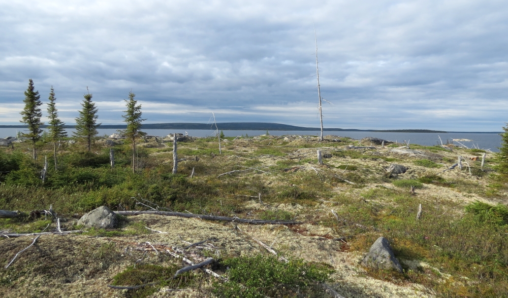
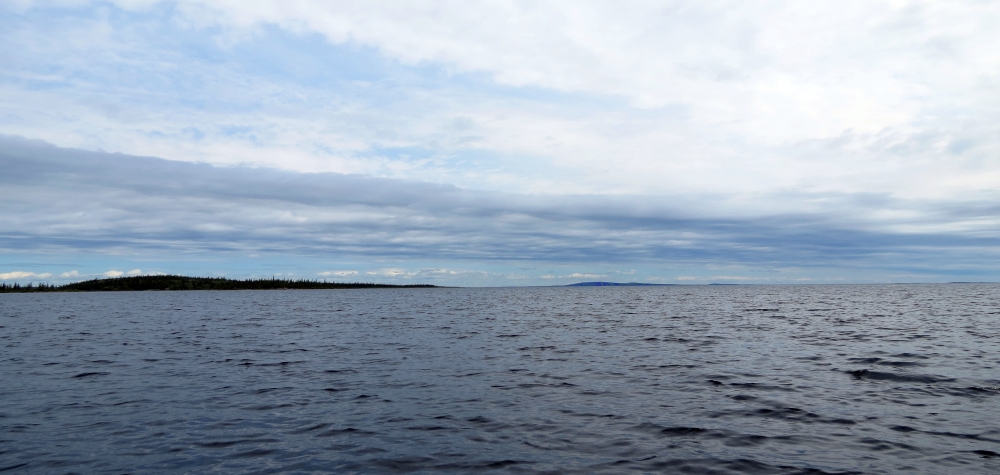
I continued on to the next target island, this time I estimated an hour or so but 2 hours passed before it was in sight and it was not making sense when comparing what I was seeing and what the map was indicating. The scale of this body of water is hard to wrap my head around; in all directions there are vast areas of open water with distant islands that are indistinguishable from each other. I figured if I just generally headed due north I would eventually get to where I wanted to be so on I went to the next island. At some point it dawned on me that perhaps I should really figure out where I was, the islands ahead did not match the map. Out came the GPS and compass and most important the 1:250 scale topo, after a few minutes of head scratching I figured out that I had made a serious navigation error at my very first turn, instead of heading north I had turned northeast, the island I intended to pass on the left I had passed on the right and then my next target was completely wrong! I was about 10km southeast of where I had intended to be. To get back on course I needed to paddle due west 6 km, pass through a shallow channel, turn north and then veer west to a camp indicated on the map.
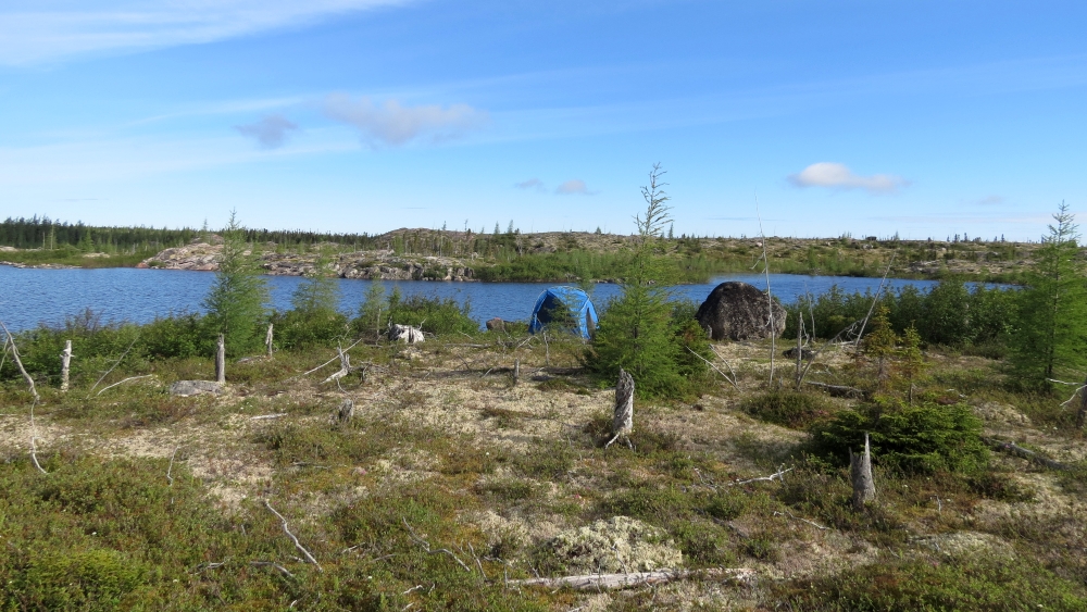
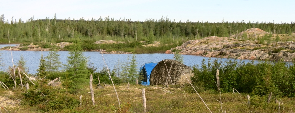
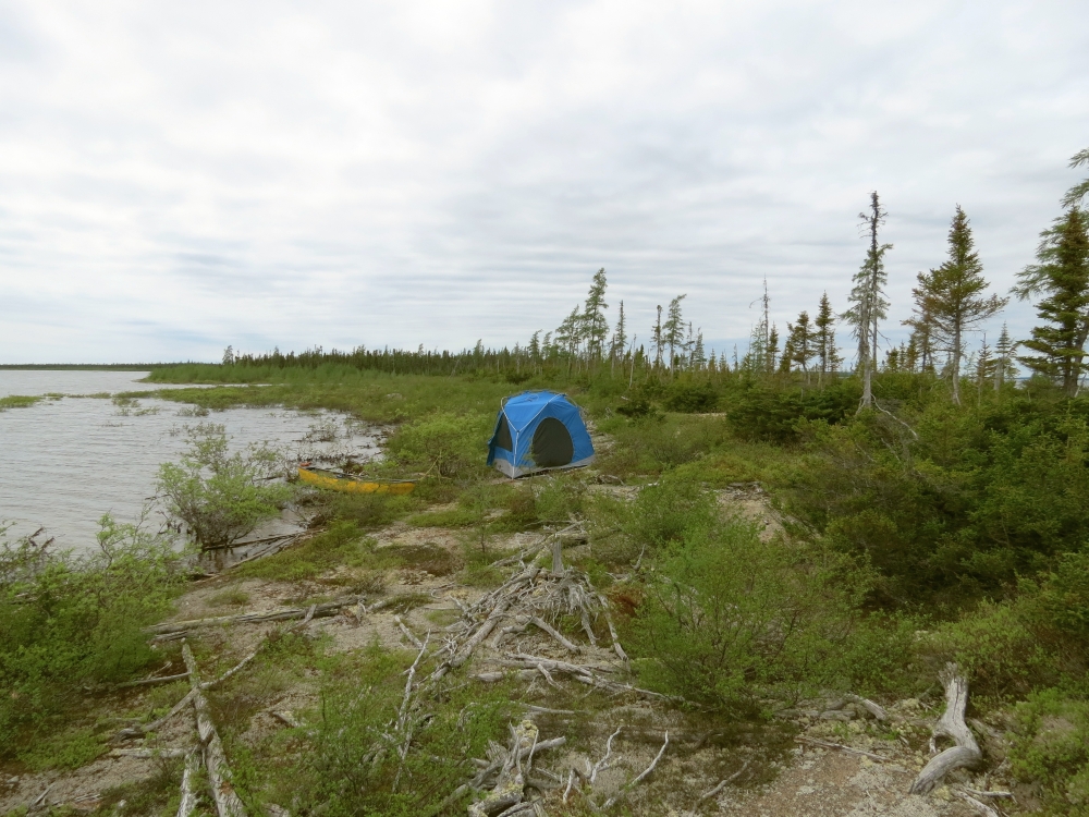
I’d been on the water for 5 hours, time for a lunch break, I drifted for 20 minutes as the sky cleared and the sun appeared then paddled along the shore to the channel, and it was 5:30 when I floated through, fortunate that there was just enough water to get through without running aground. I turned north, this time ensuring that my direction was correct. It was 11km from here to the marked site, further than I wanted to go so I scanned the nearby shoreline. The huge island on the right didn’t look too good, about 3km away to the northeast was a large (5km long) island, too far away to really see any detail but this island seemed at least to have some modest height with what looked like some areas not covered in trees. I set my sights on the centre point, as I drew close I was saddened to see the shore was hidden behind a wide band of shrubbery, I turned east and paddled towards the end where I spotted what looked like a small beach area. It was looking like this low and mostly treeless tip would be an unpleasant swamp, the first spot I checked was much like this but I lucked out and a 100m further on found an nice area of sandy ground, just a few bushes in the water to push through and just a couple of pieces of driftwood to move in order to make a clear area to put up the Pod.
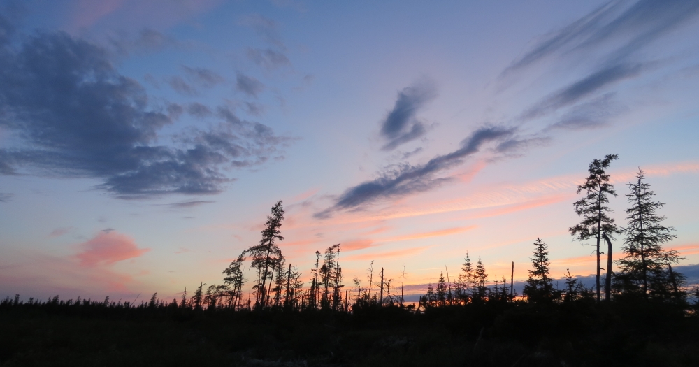
I set up camp and settled in after almost 8 hours on the water. I heated water for tea and a bag of Pepper Beef & Rice (Alpine Aire), not one of the best, very plain rice with small chewy bits of “beef?” I shoveled it in regardless and then finished off with an oatmeal raisin cookie. There is a nice sunset, the moon is shining, the loons are calling and the cool temperature seems to have sent the bugs away at least as far as inside the Pod, outside there are still plenty. I had a last smoke and got into the sleeping bag around 11:30, no plans for the morning but it won’t be 6:00am like today.
« Contents Back To The Put-In »