| Bloodvein River Solo 2015 |
|---|
|
August 18
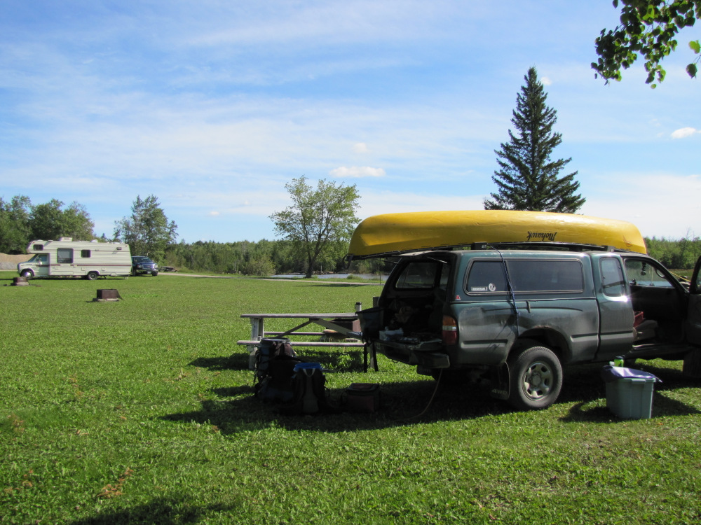
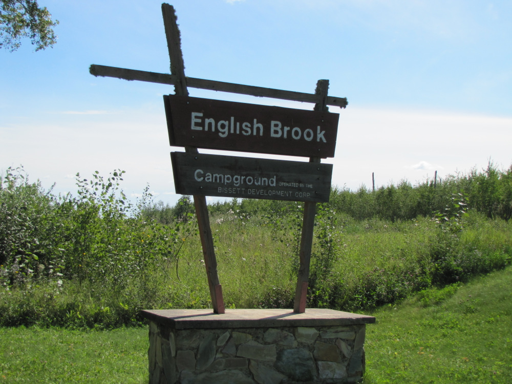
Time: 1 hr 53 min Distance: 94.8 km I headed south on the east side highway, stopping at the bridge over the Bloodvein to take a couple of pictures. The road is quite good at least as far south as Loon River where the road is much older, narrower and more twisty. I wasn't planning on going to far so I didn't rush. I reached Prov Rd 304 and turned east going a short distance to the municipal campground at English Brook. There were two trailers parked with their generators going, one was obviosuly the campground "manager" the other presumably tourist of some sort. A few vehicles came and went but in time the lights went out, generators went silent and I drifted off to sleep. |
|
|
|
August 19
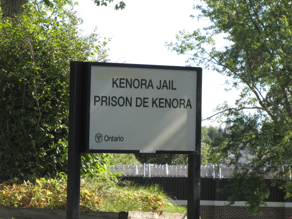
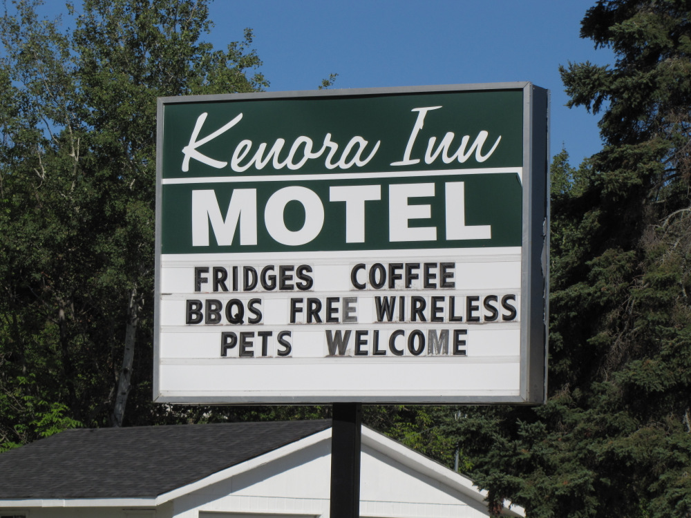
Time: 5 hr 45 min Distance: 314 km I was up at 10:00am, clear skies and warmiong up after quite a cool night. I made some breakfast and hit the road around noon. I had no particular destination in mind, I just wanted to end up somewhere that had hot water on demand! As I made my way south to the Trans-Canada Highway the cloud cover moved in. The skies got very dark but the rain held off for the most part. I stopped at Tim's in Kenora and while munching decided I had enough driving. I went off in search of accomodations, while their are lots of places in Kenora there were also lots of people. I ended up at the lowest of the low budget motels in town, concieniently located on the egde of the poor side of town between the bus terminal, a truck parking lot and the Kenora Jail! I went out for a buger and then returned to my room for shower number two and a near pointless attempt to find something on tv or go online via the wonky wi-fi connection. The big events of the day seemed to be the Ashley-Madison hack, bombings in Bangkok, Jerrod from Subway and a Trump interview. |
 |
 |
|
August 20
Time: 14 hr 57 min Distance: 1113 km I left Kenora at 11:00 spending the entire day on the road other than a few stops for food and fuel. It was 2:00 when I pulled in to my regular stealth campsite just east of Sault Ste Marie. |
|
August 21
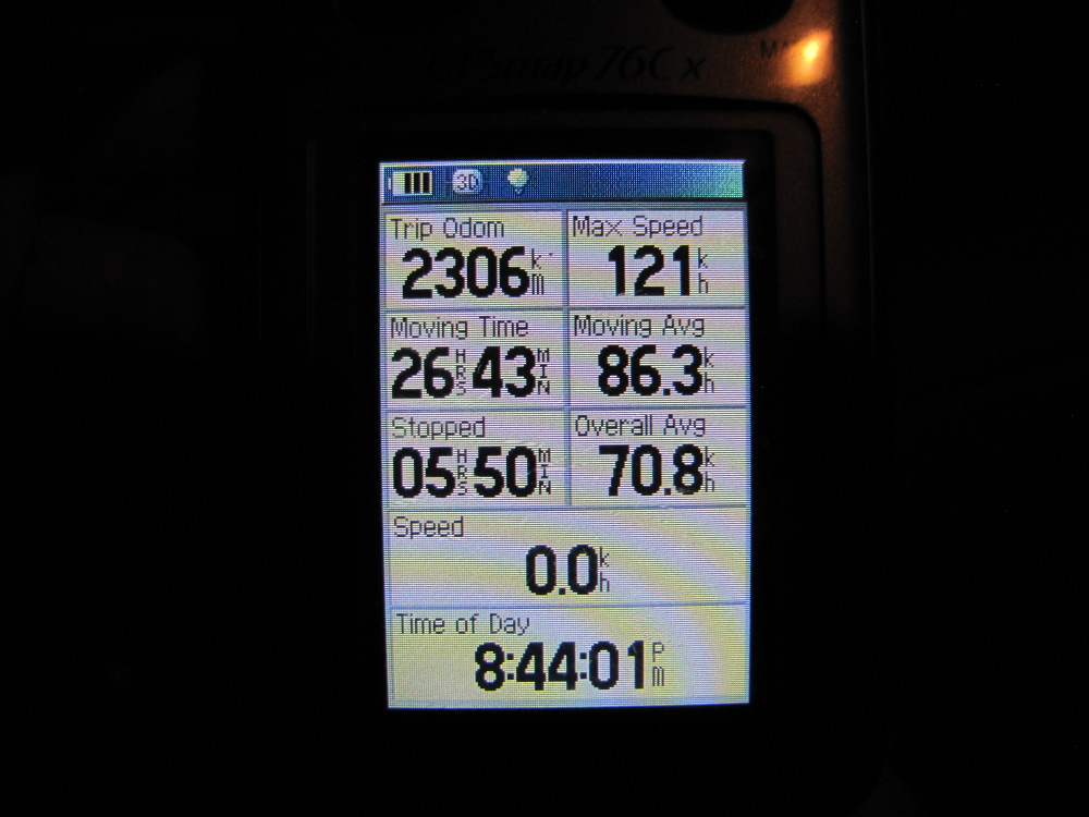
Time: 9 hr 59 min Distance: 783 km I left my spot around 11:00am and headed down the highway to the first picnic area at Batchawana Bay. The place was deserted, probably due to the $10 "day use parking fee"! I took a few minutes to dip my hands in Superior and stand around on the beach. While I was there a couple of other cars pulled in, read the sign and left immediately. Yes it's a great way to encourage tourism!!! Not too much further along was a rest area at Chippewa River Falls where I stopped to make some breakfast. Back on the road I drove pretty much non-stop finally arriving safe at home at 8:45pm. |
 |
 |
| Previous Day | Contents | Gallery |
| Main Page |